Paper Map or Phone Map for a Leisure Ride?
Paper map or phone map for a leisure ride? Compare broad route awareness with flexible detail and choose the wayfinding style that suits your day.
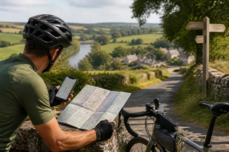
A paper map or phone map for a leisure ride changes what you notice while deciding where to go next. A paper map keeps the wider route in view; a phone map can bring a junction, path or place name into sharper focus. The better choice depends on whether your ride calls for a broad sense of direction, on-the-spot detail, or both.
Paper maps keep the wider ride visible
A folded cycling or local-area map can show the shape of a ride without asking you to move between screens. You may see a river crossing, a railway line, a cluster of villages and several possible roads at once. That broad view helps you understand how the pieces of a journey relate, rather than treating each turn as a separate instruction.
This is useful when the day’s route is flexible. If a lane looks busy or a café stop takes longer than expected, you can scan nearby alternatives and judge whether they still lead towards the same destination. A paper map also makes it easier to point out a place to a riding companion and discuss options together.
Its limits are practical. Small print can be difficult to read while riding, and a map needs to be unfolded somewhere safe and still. A paper route may also omit a newly signed path or show less detail than you need at a complicated junction. Stop well clear of moving traffic before checking it, and refold it before setting off.
Phone maps bring flexible detail to a junction
A phone map can zoom from a regional view to the street layout around a turn. Search functions can help locate a station, shop or named road, while route options may make it easier to compare different ways between two points. For riders who prefer clear prompts at each turn, that closer view can reduce the need to interpret a large map while moving.
Digital maps are especially helpful when a route changes during the ride. You can check a side road, look up a place name or request another route without carrying several printed sheets. But the screen shows only a limited area at once, so it can be easy to follow an immediate prompt without noticing a larger detour or the direction of the landscape.
Phone navigation also depends on conditions around the device. A bright screen can be hard to see in strong sunlight; weak reception may affect map detail or route updates, depending on what has been saved for offline use. Battery use, rain protection and the way the phone is mounted matter too. Check the app’s offline-map options and the manufacturer’s guidance for any mount or weather protection you use.
Choose the wayfinding style that fits the ride
Consider how much of the route you want to see at once and how often you expect to need close-up guidance. The decision is less about which format is universally better than about which one supports the kind of attention you want to give the ride.
- Choose paper for a route with several plausible branches. A broad printed view makes it easier to compare alternatives without repeatedly changing the display.
- Choose a phone for dense street layouts. Zooming and searching can clarify closely spaced turns and unfamiliar place names.
- Choose paper if you want fewer screen checks. A map you consult at planned stops can suit a ride built around looking up and looking around.
- Choose a phone if the route may change often. Live route options and map searches can help when you decide to visit somewhere unplanned.
- Consider both if each solves a different problem. A regional paper map can provide context while a phone handles the detail of a tricky approach.
Say you are planning a leisurely ride from a market town to a riverside village, with several lanes between them. You could mark the broad direction on a paper map, then use a phone to check the final turns near the village; the expected result is a visible overall route with closer guidance where the roads become harder to distinguish. That combination makes sense only if carrying and checking both feels simpler to you than relying on one.
Paper map or phone map for a leisure ride: what should you ask?
Can a phone map work without mobile reception?
Some mapping apps let you save an area for offline use, but the available functions differ. Before leaving, check that the relevant area is downloaded and learn which features remain available without a connection.
Is a paper map enough for an unfamiliar route?
It can be, if its scale and detail make the roads and junctions legible to you. Look over the route before riding and identify the places where you may need to stop for a closer check.
Should I follow a cycling route on a phone without question?
No. Treat a suggested route as information to assess, not an instruction that overrides what you can see. If a turn appears unsuitable or unclear, stop somewhere safe and compare the map with signs and the surrounding roads.
How can two riders share one map?
Agree on a simple approach before setting off, such as stopping together at notable junctions or checking the next section during a break. One rider can hold the map while both discuss the choice, so neither has to make a hurried decision while moving.
Decide by the view you want to keep
For paper map or phone map choices, ask whether you most need the route’s overall shape or precise detail at particular points. Paper tends to suit riders who want several alternatives visible together; a phone tends to suit those who value zooming, searching and prompts. If neither preference clearly wins, combine them for distinct purposes rather than carrying both by habit.
Before rolling away, check the route’s start, finish and likely decision points in whichever format you choose. Put the map or device where you can consult it only after stopping, and make sure you know how you will continue if the screen, print or route becomes hard to use. A little familiarity with the chosen map can leave more attention for the road, the landscape and the pace of the ride.